Forestiva Farm: Potential Spice Alert: Meet the Topographer
- Jun 26, 2025
- 4 min read
So… for this, my hiking bud was someone I had crossed paths with on a previous hike.
My famously flawless intuition clocked it early -she was going to be an epic hiking buddy.
And - no surprise - I was right.
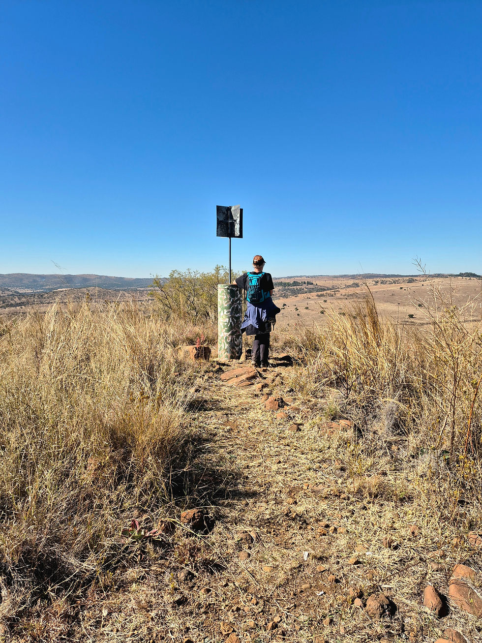
There is huge potential for this herb to be added to the rack. And she's not just some garden -variety herb - no, this one could actually read a map.
I know. I’m as stunned as you are.
Amidst the usual chaos, rogue turns, and my usual “where even are we,” I seem to have unearthed a rare specimen: someone who just might be topographer material..
Now, one hike does not a herb make. You don’t get a name just because you showed up with a compass and didn’t get us lost.

Spices are sacred.
They’re not just tossed around. Each name is a carefully curated match to personality, energy, vibe.
And furthermore - the spice rack has limited shelf space. We do not hand out names on a whim.
But “Her” (formerly Sage's name until she was promoted to spice status), showed serious promise.
Forestiva and I have a bit of history.
My first trip there with Pepper? Chaos. Rogue trails. A hallucinated crocodile - courtesy of Pepper, of course.
It was a disaster, lovingly wrapped in adventure and finished off with a regret bow - through no fault of the trail.
But I walked away knowing one thing: I needed a do-over.
And this was it.
We set our sights on the full 12 km trail, arriving early like the organized legends we were.
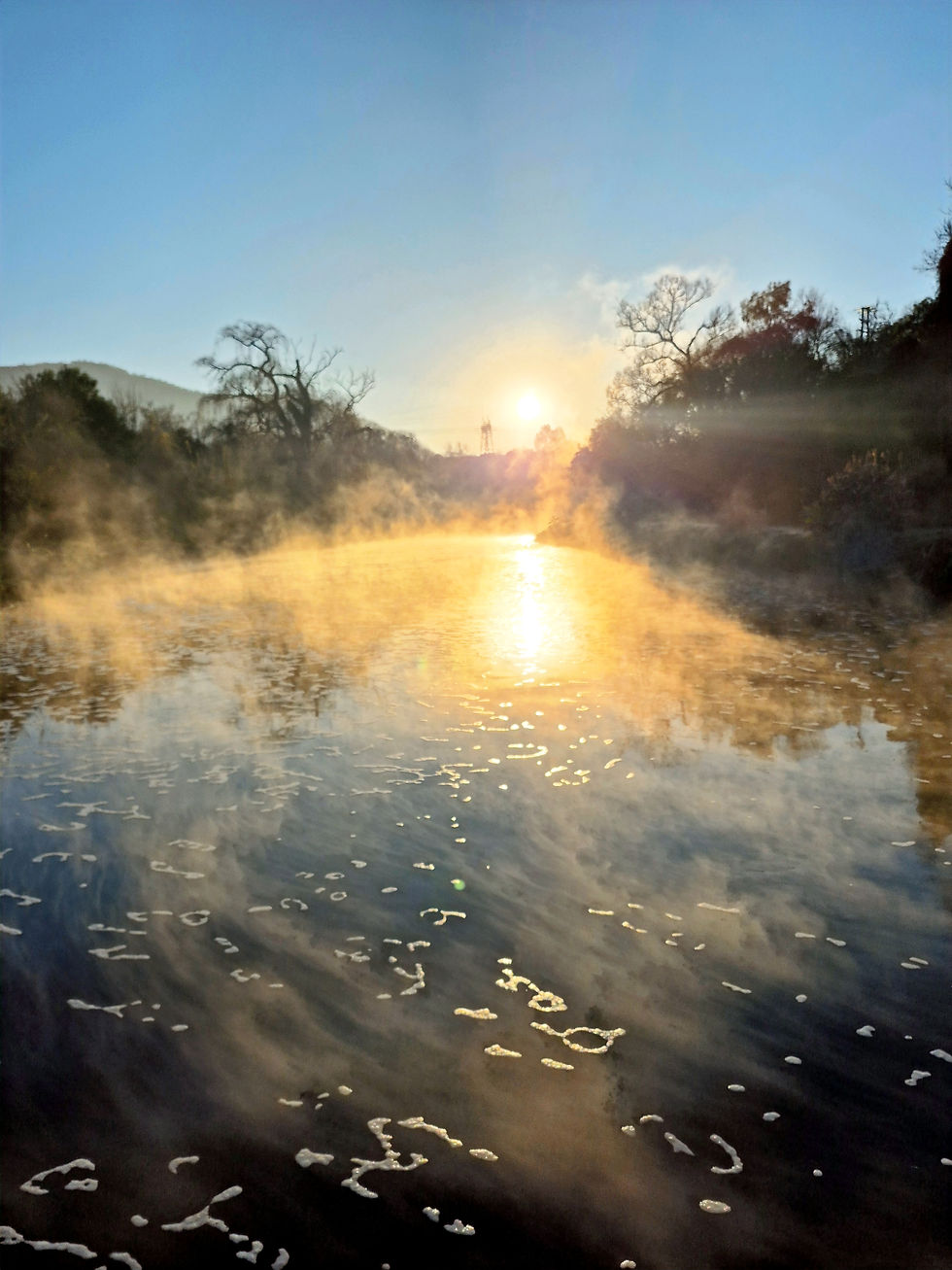
After a long sand road - which I was mentally prepared for this time - we were greeted by a mist-covered river straight out of a fantasy novel.
Honestly, all it was missing was a dragon.
The trail kicks off riverside - mostly flat, but just overgrown enough to feel like you're doing something mildly adventurous.
You're flanked by towering trees and tangled undergrowth, and at one point, it started raining leaves.
No wind. No warning. Just... leaves. Falling. Mystical.
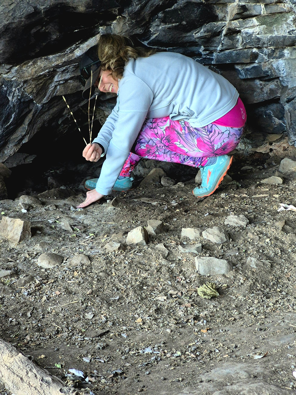
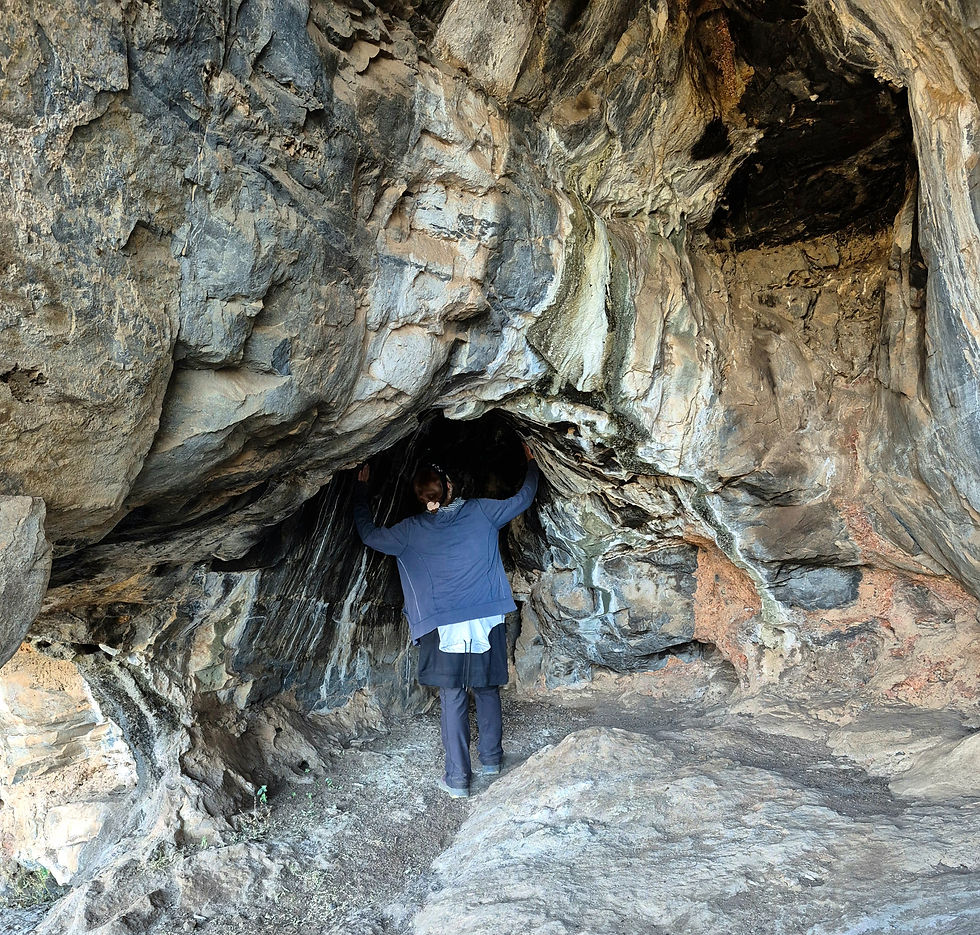
Then - the option of a detour! A cave. Who knew? Definitely less of a scramble and more of a rock-climb situation, but nothing that screamed imminent death.
Injuries? Likely.
Dramatic, slow-motion tumble to your death? Unlikely.
And the cave itself? “Her” casually noted it was camp-able - a claim later confirmed by the host.
Someone get this woman a tent, a trail badge, and possibly a crown.

The long loop does have its “extended stroll” sections (read: uninspiring but peaceful stretches), and I wouldn’t recommend it in peak summer unless you enjoy spontaneous combustion.
But the peace? Immaculate.
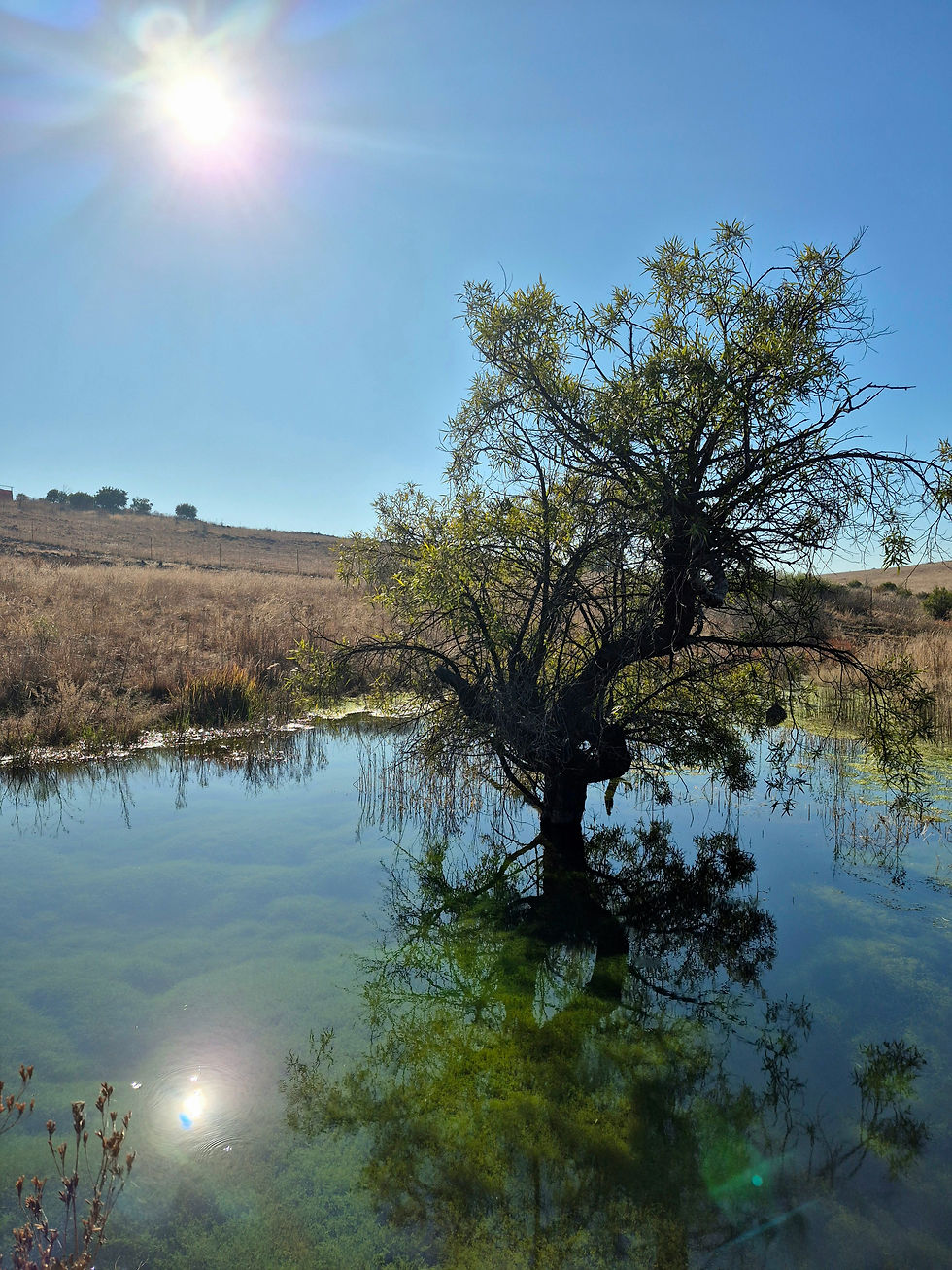
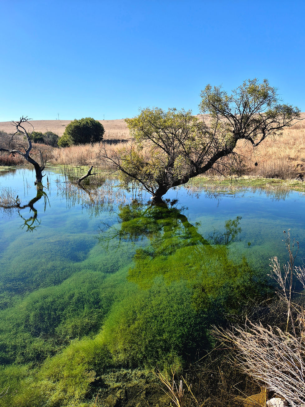
At one point, we passed a pond with the clearest water - so clear you could see all the greenery at the bottom like some underwater enchanted garden.
Absolutely magical. I assume this is where the fairies live.
Now, let’s address the elephant in the room a.k.a the litter from the river.
Yes, it’s there. I’m not pretending otherwise.
People called it out in my last post, and honestly? Fair.. But unfortunately, it’s a known issue with river trails here. The pollution sucks, but I personally don’t let it steal the hike’s joy.
It’s a reality, but for me, not a deal-breaker.
And just when we thought it couldn’t get better — Impala, gracefully springing across the plains
So to “Her” - thank you. For being the map queen, the joy bringer, the casually gangsta trail buddy who made me determined to prove that an unfortunate age gap means nothing when you're scrambling up rocks like mountain goats.
Well… you were a mountain goat. I was more of a mildly confused llama, being guided by said goat - in reverse -— down the rocks, with extremely questionable footing.
But hey, I made it.
Here’s hoping this isn’t the last trail we conquer together.
But remember… spice names are sacred.
Keep hiking, and we’ll talk.
RATING
AREA - Hennops River Valley
COST
R 80 cash or pay online - but don’t just rock up.

You do need to call ahead.
The hosts are super hands-on, which, in my experience, is always a good sign. If they care, the trail usually delivers.
DIFFICULTY
Some technical bits, slow-but-steady inclines that whack you a shot on the extended 13 km route.
Not for the faint-hearted, but manageable.
If you’re after a no-incline, beautiful river walk - the shorter trail is definitely for you.
LENGTH
13 km, including a slight cave detour.
TIME
About 4 hours if you soak it all in — definitely doable faster if you’re in a hurry.
MARKERS - Good
ABLUTIONS
SAFE FREE PARKING
AMENITIES
The host thoughtfully left tea, coffee, and rusks under a beautiful lapa overlooking the river - with a honesty box.
R 20 a cup.

ACTIVITIES
Accommodation, camping, hiking, 4x4, fishing, climbing, mountain biking, and wildlife spotting..
NOTE TO SELF
Always go back when you have unfinished business.
ON A FINAL NOTE
The long sand road is doable - just leave the sports car at home
(TO)SOLO OR (NO)SOLO
NOSOLO


Comments