Glenburn Lodge: Hiking Tips for First-Timers at Glenburn Lodge & Spa
- Dec 8, 2025
- 4 min read

I had done this trail a while back, but left feeling that the trail was rushed and also suspiciously not actually THE trail.
So I needed a redo, and who better than to take along, than my secret weapon: Rosemary—human compass, part-time topographer.
Surely nothing could go wrong?
At reception I handed all navigation duties over to her.
She was given what looked like a full thesis on directions - possibly a PhD dissertation - and I was convinced this would mark a new chapter in my hiking life: one involving clarity, certainty, and maybe even walking in the correct direction.

When the Trail Starts With “No Entry”
Let me preface this by saying: once Rosemary got home, she went through the paperwork, and discovered that buried deep in the document pile was a full PowerPoint presentation on where the trail ACTUALLY started.
So, heads up: read the thesis.
All of it.
We began in what we believed was the right direction, spotted a NO ENTRY sign, and immediately turned back, as one should.
Now, maybe this is a quirky local tradition or some kind of test of character, but when normal people see "no entry", they think, “Ah. No entry.”
Not, “Please, noble adventurer, your quest begins here.”

After wandering around like lost puppies, we finally encountered a staff member who pointed us in the right direction - through the no-entry route, of course.
From there, the markers were suddenly clear, logical, and downright fabulous.

For a while....until the end.
Trail Conditions
The trail itself? Awesome!!
You start alongside the river with enough rock-hopping to keep you focused.
The declines are loose and technical, and the inclines -short and sharp - allowing just enough recovery time to prepare for your next scheduled near-death experience.
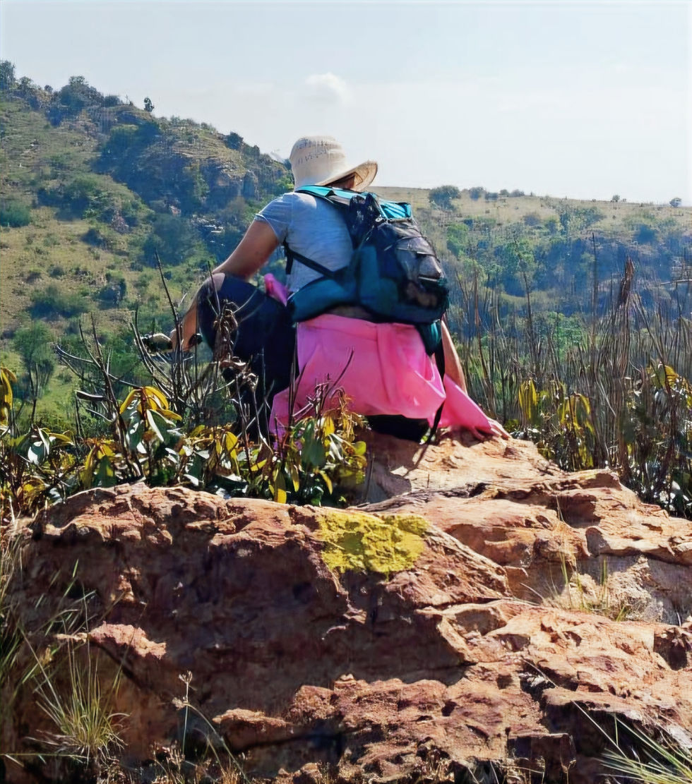
There’s also a brief but steep climb, complete with a chain to grab onto - Very gangsta. Very action-movie.
When the Trail Markings Disappear… Again
Eventually we reached what looked like the end of the trail.
But because (as I’ve repeatedly mentioned) once you’ve hiked a trail, the markers decide you’ve had
enough guidance for one day and should now navigate the final stretch to your car on your own… we were again confused.
We spotted a marker right next to yet another NO ENTRY sign. And since the theme of the day was mixed messaging, we obediently followed it - again.
This led us up a road that felt very much like the start of a bike trail. A bike trail going up.

Once we collectively declared “absolutely not” to yet another steep incline (especially considering we were supposed to be ENDING the hike, not unlocking bonus levels), we turned around, wandered aimlessly for a bit, and somehow stumbled out at the entrance - well, for us, technically the exit - of Kloofzicht.
A trail that is on our list.Just… preferably not via accidental trespassing.
The security guards were extremely friendly and helpful - possibly because they recognized two bedraggled and confused hikers.
They assured us the area was part of the same establishment, and kindly offered to shuttle us back to Glenburn.
But that’s not how we roll.
No, no. We chose dignity.
We chose pride.
We chose… to walk back along the road like two confused tourists who took the wrong bus.
Very athletic, very majestic, very us.

Wildlife Encounters
But nature handsomely rewarded us for the detour.
We spotted buck, a chilled wildebeest, and what I swear were Zonkeys—or maybe zebras going through a rebellious fashion phase.
RATINGS

Trail Information
AREA
Zwartkops, Muldersdrift
COST
R 150 (includes a R 50 voucher for post-hike food).
This would irritate me if we didn’t already default to a post-hike binge.
Still—don’t force us to snack. We’re perfectly capable of doing that all on our own.
And for some, hiking is a relatively affordable hobby; adding a compulsory snack can make it less so.
Honestly… just charge R 100.

Trail Details
TRAIL DIFFICULTY
Not for beginners. Technical, inclined and loose rocks.
TRAIL LENGTH
We did about 10 km, but there are 3 km, 5 km, and 8 km routes… allegedly.
TRAIL MARKERS
Great - except for the start and the finish. You know, the
parts people need most.
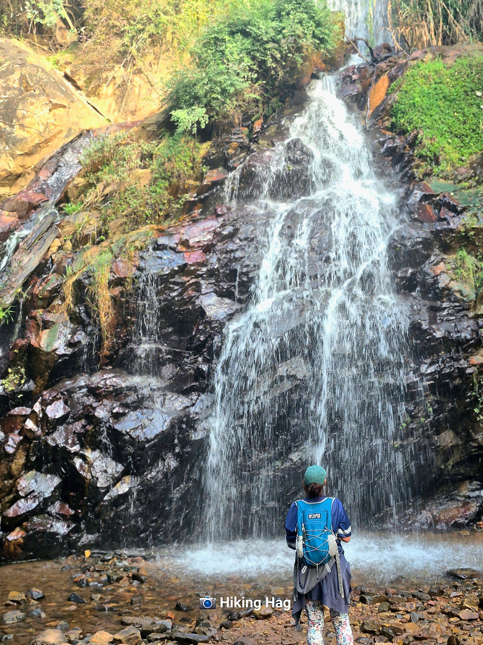
TRAIL HIGHLIGHTS
Beautiful, peaceful views… nature, vitamin D, and all the good stuff.
WEATHER CONDITIONS TO CONSIDER
It bounces between shaded and wide open.
ABLUTIONS

SAFE FREE PARKING
AMENITIES
So many… possibly even passport renewal. (Unconfirmed, but feels plausible.)
WILDLIFE & BIRD LIFE
Buck droppings and baboon warnings.
NOTE TO SELF
Buy grapes. You like grapes. Why do you keep forgetting grapes?

FAMILY FRIENDLY
Yes
PET FRIENDLY
No
ON A FINAL NOTE
Would I recommend this trail?
Absolutely. Without hesitation.
But you might want legal representation for the signage situation.
Well, that… or just read the thesis like a responsible adult.
And Rosemary, my trusted secret weapon - glad to know you’re human.
I was starting to wonder how someone so navigationally gifted could exist without being part-Waze, part-wizard.
(TO)SOLO OR (NO)SOLO
(NO)SOLO


Comments