Blue Groove Trail: Off Lead Friendly
- Feb 19
- 4 min read

This trail had been haunting my “must hike” list for a while.
Who put it there?
Was it me, a ghost, the algorithm?
Unclear.
What was very clear was that phoning them achieved nothing.
Straight to voicemail. Every time.
So the trail sat in purgatory as “maybe permanently closed.”
But something told me not to delete it.
That something was right.
A heads up - do not phone them.
Email them. DM them on Instagram.
Use any tool invented after 1971.

That’s how I finally got confirmation:
Yes, they are open, dogs can be off-lead once past reception - but they are not open over Christmas
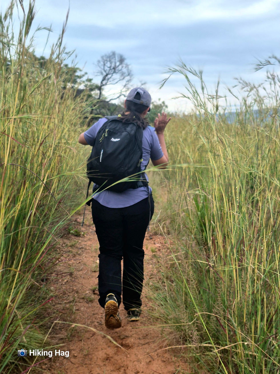
Armed with this hard-won intel - and in need of a Boris-friendly (read: off-leash) hike - Basil (Boris’s person) and I penciled it in for January-ish.
Early Starts
They open at 7 am.
Love that for us.
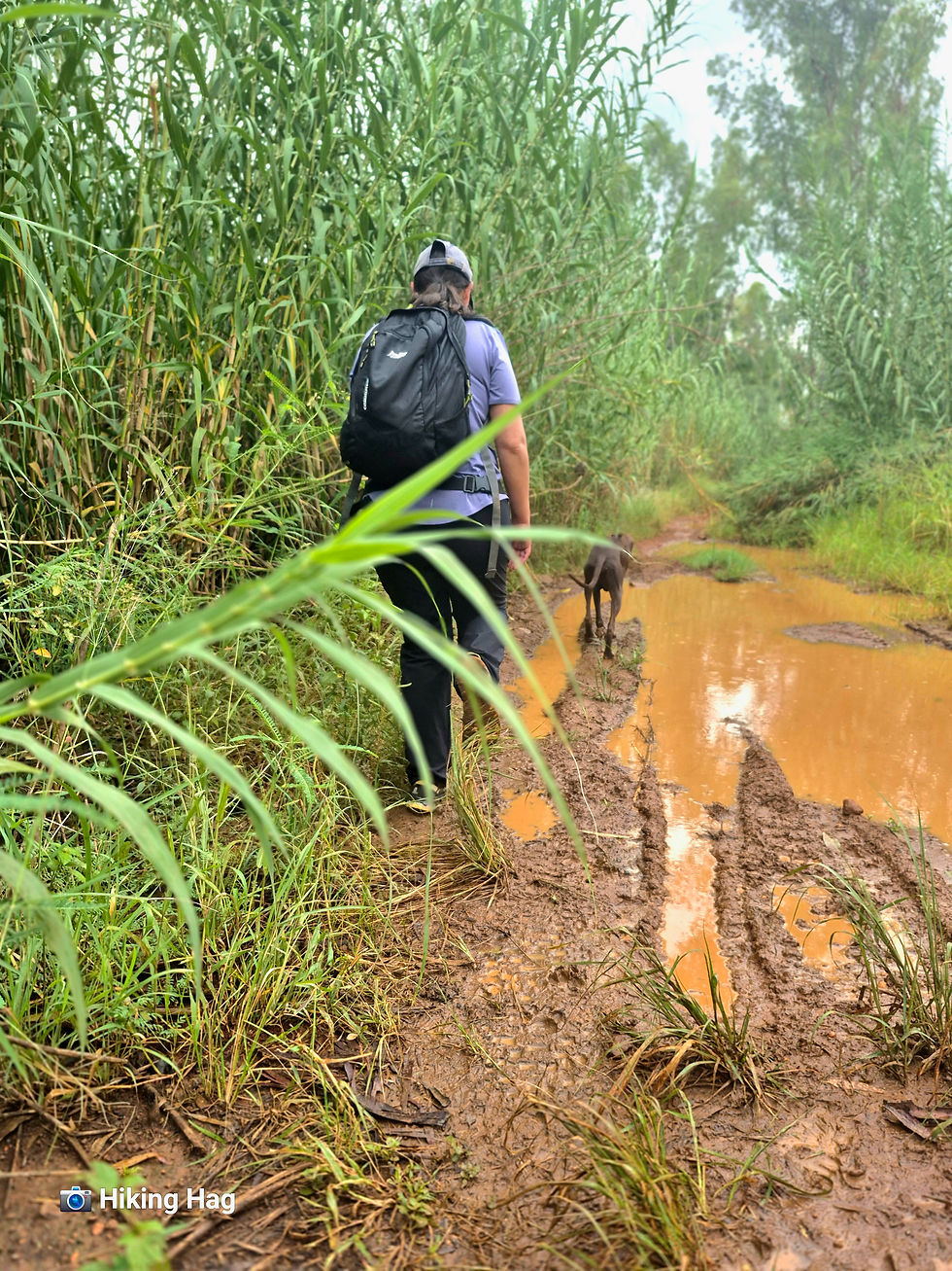
The forecast promised no rain - which was a lie, as a light drizzle arrived with us, like it had booked the same time slot and was getting a ride.

Basil did not complain.
I noticed.
I THINK she’s finally been broken in.
Fingers crossed.
First Impressions
Reception was quick and efficient.
A helpful staff member even walked us to the start of the trail and explained we should follow the yellow signs… and the white signs… because “they’re the same thing.”
We didn’t ask why there are two colours.
Experience has taught us that this question never improves outcomes.
This is not our first rodeo.
We are tired.
We adapt.
Anyway—we didn’t get lost.
Not "lost" lost.

Did we take a few unnecessary scenic detours?
Possibly.
By “scenic detours,” I mean the moment near the end where we hit a fork.
Basil suggested right.
I said - confidently - “I am 100% sure it’s left.”
This was, objectively, the point at which we should have stopped listening to me.
I am not, nor have I ever been, a reliable source of direction.
My confidence alone should have triggered an intervention.
We went left anyway and eventually came face to face with a very muddy section, which is when I became 100% sure it WASN'T the right way.
We carried on, got through it with surprisingly little drama, and - somehow - found our way back.
To be fair, this wasn’t entirely my fault.
All trails obey the same universal law - signage disappears precisely at the moment reassurance is required.
Given those conditions, a confidently incorrect decision was inevitable.
The Trail
The weather redeemed itself: drizzle breaks, light wind, cool air.
Ideal hiking conditions.
Parts of the trail overlap with African Swiss Trail
I know this because someone explained it to me very slowly, like I was five.
It was either Boris…or Basil.
At this point, it’s hard to say.
Honestly, both are equally qualified when it comes to compensating for my sense of direction, and I’ve learned that the most efficient strategy is to follow whoever sounds the most confident.
Sometimes that’s Boris.
But while African Swiss is a neighbour, the trail felt different.

Blue Groove seemed calmer, slower, and more meditative.
We were the only hikers, which is, of course, the dream.
Paying Attention
This is primarily a motorbike and 4×4 park, which comes with terms and conditions.
Firstly: riders may cross your path.
It’s not frequent, but when it happens - step aside, be polite, and resist the urge to panic like a startled antelope.

Secondly: the descents are technical.
Loose rocks, bike-worn paths, and just enough instability to demand your full attention.
Take it slow. Watch your footing. You’ll be fine.
The incline, however, is merciful - gradual, steady, and very reasonable.
No dramatic gasping. No lung betrayal.
Views, Vibes & Why It’s Worth It
The views are wide, peaceful, and quietly impressive.
Nothing over hyped, just solid, soul-reset scenery.
The trail clocks in at around 6 km, which is not long, but between the inclines and careful descents, the trail feels substantial without being punishing.
RATINGS
Trail Information
AREA
Hartbeespoort
COST
R 75 per person
Trail Details
TRAIL DIFFICULTY
Moderate
TRAIL LENGTH
Approximately 6 km
TRAIL MARKERS
Yes… technically.
Chaotic, but functional.
TRAIL HIGHLIGHTS
Peace, views, quiet
WEATHER CONDITIONS TO CONSIDER
Fully exposed; we were just lucky
ABLUTIONS
SAFE FREE PARKING
AMENITIES
There’s a whole setup- coffee shop, fire pits, braais, seating, a bar.
It looks great.
For people.
Not me.
Obviously.
I am not people.
There’s also paintball, go-karts, and archery.
An entire adventure park.
If your idea of fun includes corporate icebreakers, trust falls, and someone named Craig yelling “LET’S GO TEAM,” you’re going to have a fantastic time.
I, personally, will remain seated, quietly drinking coffee and avoiding eye contact.

WILDLIFE & BIRD LIFE
Boris.
Some monkeys.
End of list.
NOTE TO SELF
More quiet places.
Less everything else.
FAMILY FRIENDLY
Yes
PET FRIENDLY
Boris. Obviously.
ON A FINAL NOTE
If you want a peaceful, off-lead dog-friendly hike and zero crowds, this one delivers.
(TO)SOLO OR (NO)SOLO
(NO)SOLO


Comments